|
|
|
Sir Arthur
Conan Doyle, |
Arthur Conan
Doyle,
The Great Boer War.
London, Smith, Elder &
Co., 1902.
Map
Index
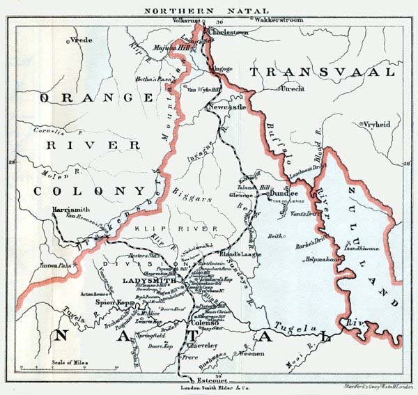
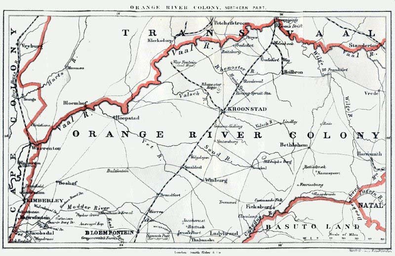
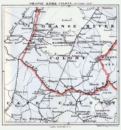
Conan Doyle included
four reference maps in The Great Boer War. These included maps of
Northern Natal,
Southern Transvaal, and the
Northern and Southern parts of the Orange River Colony. Reduced copies of
each map are presented below. Each map has a link to a full size map. Please
note that the larger maps range in size from 250k to 360k.
| Northern Natal |
 |
| Southern Transvaal |
| Orange River Colony (Northern Part) |
 |
| Orange River Colony (Southern Part) |
 |

|
Arthur Conan Doyle,
The Great Boer War. Preface and Table of Contents |
